Profile
Busuanga,
Palawan
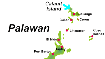
Map
of Palawan showing the location of Busuanga
Busuanga
is a municipality in the province of Palawan, Philippines. The
territory of Busuanga covers the western one-third of Busuanga
Island, which is part of the Calamian Group of Islands lying between
Mindoro and mainland Palawan. Its population as of year 2000 is
16, 287 people.
Barangays
Busuanga
is politically subdivided into 15 barangays. (arranged in alphabetical
order)
-
Bugtong
-
Bulwang
-
Burabod
-
Busuanga, New
-
Busuanga, Old
-
Cheey
-
Concepcion
-
Halsey
-
Maglalambay
-
Panlaytan
-
Quezon
-
Sagrada
-
San Isidro
-
San Rafael
-
Santo Niño
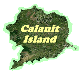
The
Calauit Island
Calauit
Island Wildlife Sanctuary.
A great experience for the whole family. African animals from
the country of Kenya such as giraffes, elands, zebras and gazelles
co-exist with endemic Philippine animals like the Palawan bearcat,
mousedeer and peacock pheasant lived and freely to go-around in
a 3, 700 hectare land area. Every visitors are required to get
and secure a permit at the Office of Palawan Council for Sustainable
Development located in Coron. There are no regular transportation
facilities in the area, thus, you are advised to hire a vehicle
in the island.
back
to top